Public Art + Community Workshop Project on Staten Island
Despite warnings from city leaders, experts, meteorologists, and the media, many residents of New York City who lived in flood zones refused to evacuate before Superstorm Sandy hit the city in 2012. Sadly, at least 43 people died when the storm hit, almost half of them on Staten Island. The reasons people refuse to evacuate during extreme weather events vary and include distrust of local leaders, the media, and experts, as well as the human belief that tragedy happens to other people.
We know extreme weather events are increasing in number and severity, so for the fifth anniversary of the storm, my team and I wanted to explore how the residents of New York’s hardest-hit borough viewed things with the benefit of time. Perhaps unsurprisingly, the same distrust and disbelief had only grown over the years. Moreover, the city had recently redrawn the flood zone maps, adding complexity to a poorly understood tool vital for preparedness.
We interviewed dozens of people and realized that when the next storm hits, most residents would again choose to remain in their homes and expose themselves and their families to danger. Rather than run a story that shamed and mocked their position, we applied our design training to the problem and decided to meet them where they were with the best information we could supply.
Our approach was two-pronged; first, we worked with local community leaders and our partners at IDEO and Parsons School of Design to create a human-centered design workshop that focused on uncovering each resident’s superpowers that would be useful during an extreme weather event. The idea was to surface and share these skills with community members so they could lean on each other if needed.
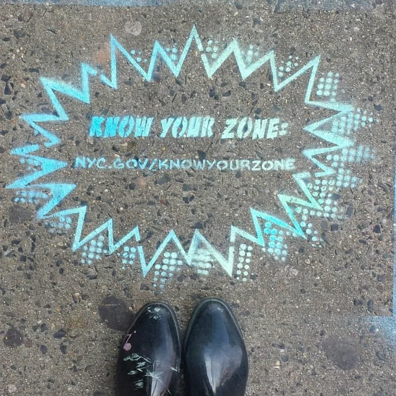
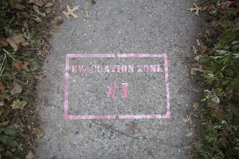
However, we still had the challenge of informing residents about the new flood zone map. Typically, a news organization would publish the map on its website and share it on social media. We knew this would reach only a tiny fraction of residents, particularly on Staten Island, as it’s the borough with the fewest WNYC news consumers.

Drawing on my background in fine art, I designed a public art project/installation that endeavored to spray paint the flood map on the sidewalk in the Midland Beach neighborhood where most people died during Sandy. My team and I designed stencils with the flood zone numbers, colors, and a URL where residents could learn more. I also knew that the act of spray painting on the sidewalk during the day would cause many residents to confront us as if we were vandals. When they did, we could inform them of the new flood map, ask them to spread the word, and promote our workshop later that evening.
The project was a huge success. We installed the map, spoke to dozens of residents, and held the workshop for a packed house.
My reporter, Clarisa Diaz, and I made this video to memorialize the project. You can read more about it here.